Physical and Geographic Location
The main part of Lublin is located at the eastern end of a long ridge.
This ridge forms the southern side of the steep sided Czechowka river valley,
whilst to the south it descends into a dry and shallow valley. Wieniawa
is situated on the northern slope of the ridge, to the west of the city.
Along the top of the ridge run the Krakow and Pulawy (Warsaw) roads, defining
the southern border of the village itself. The side of the valley has many
dips and steep sided gullies, typical of the Loess and sandy soil they
are formed from. The Czechowka is very small, averaging about 4-5 feet
wide, but once it flowed into a lake near the main part of Wieniawa. The
shape and layout of Wieniawa in the present, as in the past, is defined
by the gulleys and spurs it is situated in and on.
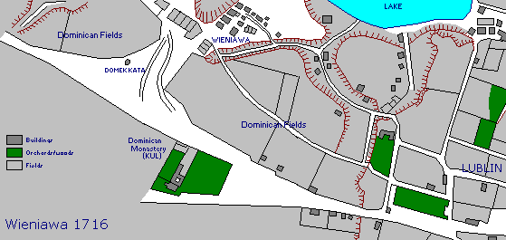
Wieniawa itself was situated on a flat topped spur just above the Czechowka river and lake, with the centre of the town at the western end and the cemetery at the eastern end. The location of the town can be seen quite clearly on the 1716 map. Although the river course was altered and the lake filled in the late 1960's/early 1970's, this spur and the gully which runs on the south side of it make finding the location quite easy today, even though the area is mainly built up today. Other features are the hang man's house, the Catholic University and the Lutheran church (the latter did not exist in 1716, but the manor and attached lands which were purchased to build the church, does)
Outline History of Wieniawa
The first record of this place was as a village owned by the Lubomirski
family, later, in the 18th century, it was the property of the Tarlow family.
In the early part of the 17th century the elected king, Zygmunt III Wasa,
a Swede, moved the capital of Poland from Krakow to Warsaw. Thanks to this,
Wieniawa found itself on a new trade and administrative route and the Leszczanski
family, current owners of the village, obtained town rights for the village.
The name of the village, now a town, comes from the name of the coat of
arms of the Leszczanski family, called Wieniawa. This town was established
and existed in private hands until 1826, when it was bought by the state.
The trade route can be followed today from Lublin Old Town as ran along
today's Zielona, Radziwillowski, Powiatowa and Leszczynskiego Streets.
Leszczynskiego Street was named after the owners of the town, but later
the name became confused with a king of Poland of the same surname, and
King Stanislawa Leszczynskiego Street is its name today.
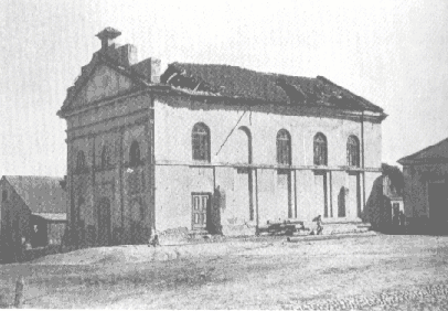 The Synagogue
in 1916.
The Synagogue
in 1916.
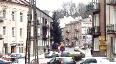
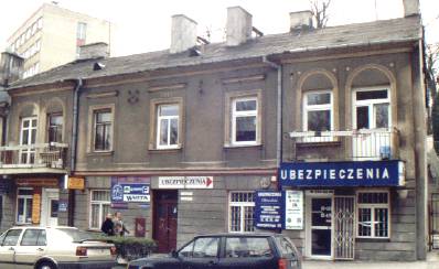
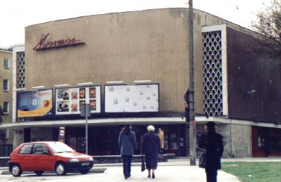
Where the Kosmos cinema stands today was the market square, the present junction of Stanislawa Leszczynskiego and Dlugosza Streets. Most of the population were Jewish and their brick built, and notable, synagogue stood in the middle of the market square. Wieniawa was famous for its inns and taverns. The building at 50 Leszczynskiego street dates from the first half of the 19th century and originally was the town hall (Magistrat). Between Leszczynskiego and Solidarnosci stood the Jewish cemetery from the second half of the 18th century until 1940.
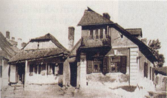
 A Wieniawa
Tavern, a photo from the 1920's/30's. This was located by the edge of the
Czechowka river, the shed in the foreground being on the bank. The probable
location of this building is east of the lake, another picture I have seen
shows the Czechowka river, just out of sight below the picture shown here.
A Wieniawa
Tavern, a photo from the 1920's/30's. This was located by the edge of the
Czechowka river, the shed in the foreground being on the bank. The probable
location of this building is east of the lake, another picture I have seen
shows the Czechowka river, just out of sight below the picture shown here.
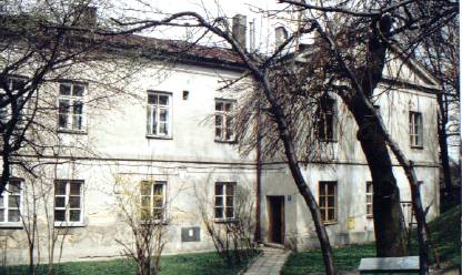
To the south of the town, or village as it then was, a wooden church was built on the top of the ridge in 1434. The church was founded by a merchant, Henryk of Gdansk. Reputedly he stole the fragments of the Holy Cross that once were kept in the Dominican church in Lublin's Old Town. His horses failed him as he got to Wieniawa and he realised that he was not going to get away with the deed. In restitution he had the church built at the point he turned back (Note: These fragments of the 'True Cross" remained in the Dominican church until they were stolen a few years ago). This church survived until the 17th century when it was given to the Dominicans, along with a significant amount of land. The wooden church was replaced with a brick one in the Renaissance style in the years 1617/29. It was given to the Dominicans, along with a significant amount of land, in 1677. At the start of the 18th century they decided to establish a monastery, and buildings were constructed on the north side of the church. In 1800 the monastery was closed down by the Austrians, who controlled this part of Poland at that time, and they established a military hospital there. During the next few years they extended the buildings by first building 2 new wings and then connecting the open end with a new building to form an enclosed courtyard. It was constructed as a miniature of the Wawel castle in Krakow and was known in the latter part of the 19th century as the Swietokryskie barracks, after the nearby Orthodox church. When the Austrians left and the Russians replaced them it still remained in the hands of the military as a barracks. After the Russians left after World War 1, it was first became a local hospital, and then shortly afterwards was given by the government to the Catholic Church so that they could establish a university there. The university remains to this day, known as Katolicki Uniwersytet Lubelski (KUL).
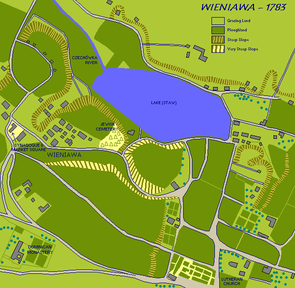
Map of the town and the surrounding area in 1783.
Set back among trees on Dlugosza Street ("Do Wieniawy" on the 1912 map) is a building unique in the whole of Poland. It is called Domek Kata, or Gallows House. Here is an octagonal building that originally had no windows on the ground floor as it was the prison for condemned criminals. Above this was an open area with the gallows, open so that people could come and watch the hanging. It was built to serve the whole of the city of Lublin, and it is probable that either its location was chosen as being convenient for the Dominican church, or vice versa. By the time of the Austrian rule it had ceased being used for this function, and instead the gallows part had a roof and walls built and was used for the storage of gunpowder. When the nearby Saski park was opened in 1837 it became the gardener's house. These days it is privately owned, although it is hoped that one day it will be possible to examine the building more closely as it is suspected that it has interesting cellars.
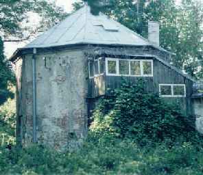 Domek
Kata, the Gallows House. This is marked "29" on the Lublin 1912 map.
Domek
Kata, the Gallows House. This is marked "29" on the Lublin 1912 map.
One of the biggest changes to the area of the town came in the first half of the 19th century. Now that the town was no longer in private hands it was decided to construct a park in the southeast corner of the village lands, just outside of the the then current city limits. The land chosen was part of that formerly owned by the Dominicans, and work started in 1837. The style chosen was in the Romantic English tradition, although later it developed into a more natural style. The old roads were generally retained and so you can still walk along wide paths that once led to Wieniawa. Of course, the park is mainly wooded, whereas before 1837 it was mainly farmland. The park is known as Ogrod Saski (Ogrod=garden, Saski=Saxon), not the original name but one that was adopted by the population of Lublin to emulate the park of the same name in Warsaw.
On the southern edge of the park, just opposite KUL, there is a mound and on the mound stands a brick and plaster shrine (kapliczka). Recent excavations have revealed that it was originally a circular Neolithic burial mound (tumulus), and pottery dating back to 2000 BC has been recovered. Since the coming of Christianity, when it was common practice in Europe to establish churches or chapels on 'heathen' sites, it has had a chequered history.
 Shrine
opposite KUL.
Shrine
opposite KUL.
It is probable that in the middle ages there was a large wooden cross on the top of the mound, the current structure probable dating from the 18th century and connected with the building of the Dominican monastery. The figure in the shrine is that of Jesus, but this is not the original statue as it replaced an earlier one dedicated to St John. There are various legends attached to the mound, one is that there used to be a gallows on it, and the other that the shrine was established by a woman in restitution for being a prostitute. The origin of the gallows story probably comes from the time when criminals were hanged in a nearby building and buried in the mound. Other burials in the mound include plague victims. The mound is no longer circular, wear and tear over the ages, and a bit of trimming to suit the outline of the Saski park and road widening projects have left it a more oval shape.
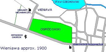
On the map of about 1900 there is a factory shown in Wieniawa, or at least some kind of mechanics works (Zaklady Mechaniczki). This map does not show the Dominican Monastery/KUL, which was only a soldiers barracks at the time. The Orthodox church still exists today, but was completely changed in the 1920/30's as a Roman Catholic church and is unrecognisable now as the same church.
At the western end of the town, by al. Raclawickie (Warszawska Street on the 1912 map), there was a Jesuit Monastery established in 1922. The monastery was named after St. Andrzej Boboli and was designed to train missionaries to Russia in the hope of forging closer links between the Catholic and Orthodox churches. The main building and one wing was constructed, but before the plans for a second wing could be fulfilled, the Second World War happened. During the war it became a military hospital, and thus it has remained until this day. The gardens established by the monks were maintained by the patients until about the 1970's, and it was a useful source of fruit and vegetables for the hospital. In 2001 the land of the gardens was finally handed back to the Jesuits, but the buildings themselves will remain as a hospital for some time yet.
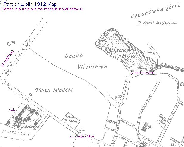
The 1912 map shows that Wieniawa was still outside the boundary of the
city of Lublin. On the map are several points marked "52", these were the
city boundary stones. However, at this period there was a lot of building
activity in this part of lublin, on both sides of the boundary. As this
corner of Lublin was probably still one of the most stylish and prosperous,
with many of the city's important buildings being located here, it is probably
the reason why the German chose this part of Lublin to be their own.
The newly destroyed town of Wieniawa made a very convenient place for
their new stadium. Note that this maps does not show general buildings,
only the most significant ones.
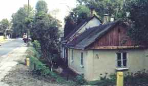
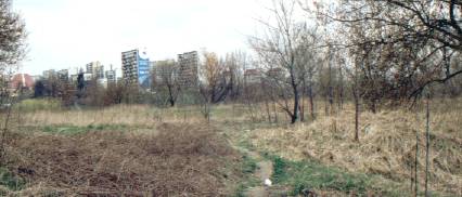
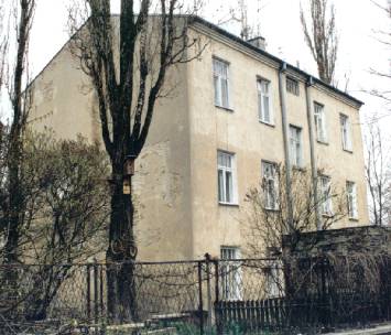
The lake, filled in in the 1970's to make way for a new highway, was used both as a fish pond and as a source of ice. In the days before refrigerators ice was in demand in the summer months by food merchants and homes that could afford it. Ice was cut in the winter and stored in piles, with a thick layer of sawdust as insulation. This practice continued up until the 1960's. If you compare the 1783 and 1912 maps you can see that by 1912 the lake was already much smaller, no longer stretching almost completely over the valley floor on the northern side. In fact, the 1912 map indicates that there was an area on the north side of the outflow which was no longer part of the lake proper. By the 1960's the lake had become even smaller, possibly as the result of being partly filled in at one stage. Even on the 1912 map the lake is still beside Czechowska Street, but by the 1960's the area on the north side had been filled in and was the PKS (A national coach company) fuel and repair shop. On the south side of Czechowska street are some houses from the turn of the century, one at least still showing the signs of being a villa.
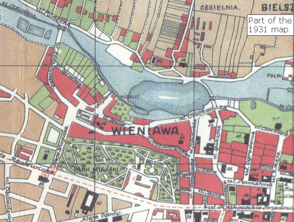
The 1931 map shows how the area had changed since before the first world war, with the lake appearing to have silted up to almost half the size at its northwestern end. The jewish cemetery, 'kirkut', is of its final shape and size and it is no longer possible to see where Lublin finishes and Wieniawa begins. From the positions of the Rynek, the former Dominican monastery (the Catholic University, KUL, since 1921) and the Lutheran church (marked '93' on the map) still give us some idea about the locations of other places.
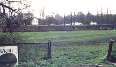
Administratively, Wieniawa belonged to Konopnica gmina throughout most of its history, not Lublin, even though Lublin is much closer. It was finally incorporated into the Lublin gmina in 1916. The town ceased to exist in 1940 when the population were relocated to the Lublin Ghetto (by the castle) and most of the old buildings, mainly wooden, were destroyed by the Germans. This included the very interesting Synagogue from the beginning of the 19th century. On part of the town and the Jewish cemetery the Germans built a stadium, which still exists and is now called the "Stadion KS Lublianka". The area of the cemetery itself is no longer used, although it is enclosed within the area of the stadium. It is possible that the cemetery area was used for sporting events, but if so they ceased some time ago as the area is now abandoned and used only by the local drunks. The cemetery itself was already established by the second half of the 18th century, and was used up until 1940. Tombstones from the Jewish cemetery were used to strengthen the foundations of buildings on Spokojna Street, were some were recovered during recent renovation. these tombstones have now been relocated in the 'new' Jewish cemetery on Walecznych Street. On the site of the synagogue there was built a cinema in the 1960's, although it is possible that the road junction in front of the cinema also is part of the synagogue as the road has been re-aligned either at the time the stadium was built, or earlier. At the time the cinema was built it was much praised for its modern style, but it is now sadly decayed.
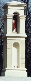
There was a famous composer and violinist at the end of the 19th and beginning of the 20th century who was Jewish and born in Lublin. The family changed their name and chose to take the name of (Henryk) Wieniawski, from the district they probably knew well. There is a monument in Lublin dedicated to him, as well as a district named after him.
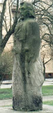 Monument
to Henryk Wieniawski, a Lublinian Jewish violinist of some note.
Monument
to Henryk Wieniawski, a Lublinian Jewish violinist of some note.
Around the period of the first world war it is recorded that there were the following Jewish businesses: Moszek Grifeld had an oil mill (olejarnia), there was an organisation called "Zwiazek Zawodowy Robotnikow Tabacznych".
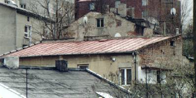
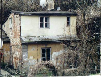
Remnants of Wieniawa
Since the destruction of the main part of the village during the second
world war, very little remains of the village itself, but there are still
some buildings, belonging to the state or church, that still exist. The
most noticeable feature in its absence from modern maps is the lake. This
existed until at least the late 1960's, when it was drained and filled
in before the building of a new dual carriageway highway took place. The
sides of the valley are dominated by housing and blocks of flats mainly
dating from the 1960's to the 1970's, with earlier buildings at the eastern
end.
The Saski park still retains the land visibly in something like its original form, as does the gardens of the former Jesuit monastery. The Dominican Monastery lives on as the home of the Catholic University, and the hangman's house (Domek Kata) is hidden behind a college.
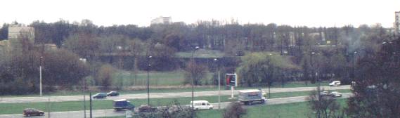
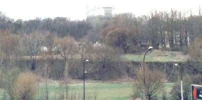
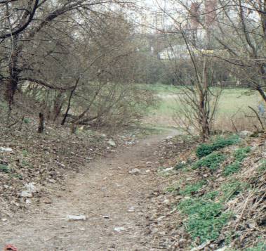
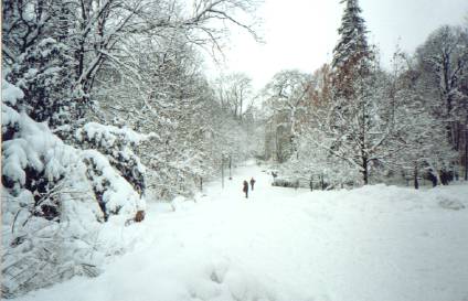 This
is the Saski park, and what is now a broad path through the park was once
on of the roads into Wieniawa. This is the view towards Wieniawa.
This
is the Saski park, and what is now a broad path through the park was once
on of the roads into Wieniawa. This is the view towards Wieniawa.
Below is the same map as above, but now with the modern streets overlaid. The creation of the map was made possible largely by the fact that the Lutheran Church and the Dominican Monastery (now KUL) have remained throughout the multitude of changes that have occurred. Of course, the present street system has developed over the last 200 years, but the original road layout still exists although in a modified form. The four most significant changes to the 'landscape' are the change from agriculture to city, the creation of the Saski Park, the building of a sports stadium, and the draining of the lake. On the map the Saski Park is dark green, the Stadium pink and the filled in lake greeny-blue. Note that one of the road names, in the top left corner, is called Przy Stawie (By the lake). The road 'Wieniawska' used to be called Starowieniawska, before the Communist period. Al. Tysialecia is the new road that led to the filling in of the lake.
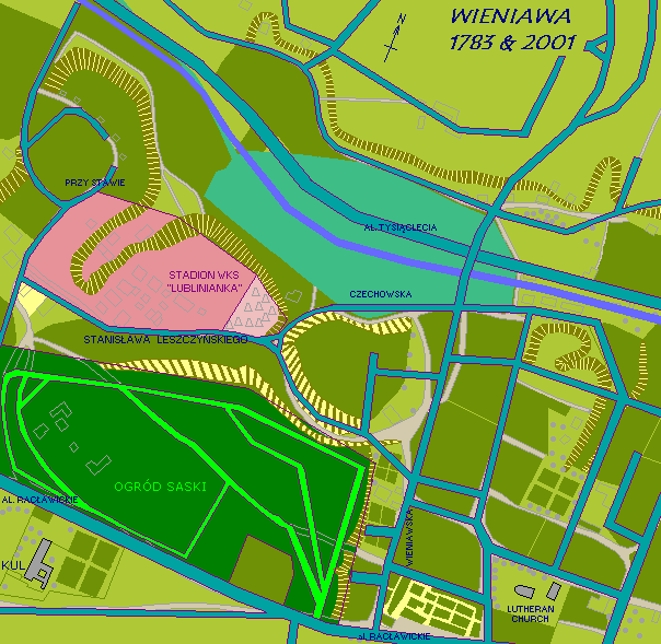
You can see that there has been little change in the basic road system around Wieniawa, although there are a lot of minor changes. This is quite good when you consider that it covers over 200 years! You can see that most of what was the small town of Wieniawa of the 1780's has disappeared under the stadium area, this being the part of the town that was demolished. The following map gives more detail, and demonstrates a basic fallacy common to guide books here in Lublin that state that the cinema was built on the site of the former synagogue.
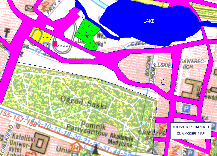
The pink parts are the roads from the 1931 map, they are not precise but they are accurate enough to show that both the rynek (town square) and the synagogue lie under the stadium, something which can be guessed from the 1783 map. Many people writing about the town have failed to realise that Leszczynskiego street was realigned at its western end, and the location of the cinema is about 50m south of the old alignment. Even worse, the same people have assumed that the synagogue was also on the south side of the street, when all maps show it on the north side, beside the rynek. The only continuing bone of contention, the land of the former Jewish cemetery seems mainly to be unused, except for one corner which has long since disappeared under the banking bulldozed up for seating around the main stadium. The current plan for the area (2002) is that the stadium is going to be replaced by a more modern one, with the former cemetery left as a grassy island in the middle. One wonders if local archeoligists will take the opportunity to have a dig while the work is under way.
Curiously enough, it appears that the western edge of the Saski park has been extended, the current Dlugosza street lying some 30-40m to the west of the previous roads alignment. I estimate that this might have occured in the early 1930's, a time when this area was set to become the new western suburbs of Lublin, as at the northern end of Dlugosza, on the eastern side of the road and next to the cinema is a block of what appears to be inter-war flats. The park also gained some extra land since 1931 as the area currently owned by the Akademia Medyczna is much smaller than on the 1931 map, the outline is still defind by the path which used to go around the area.
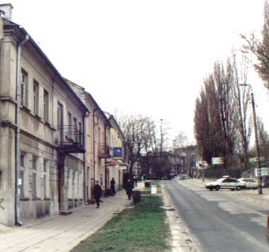
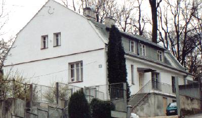
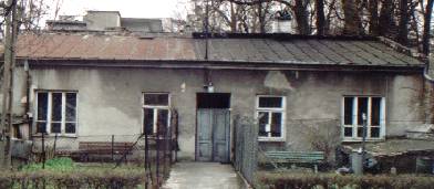
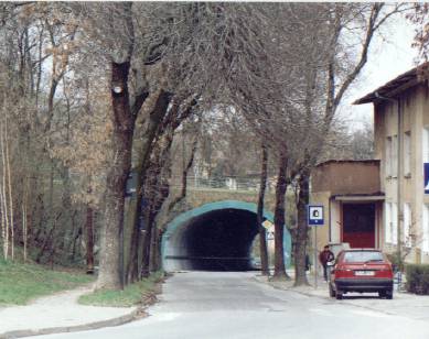
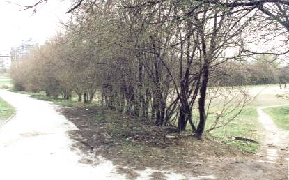
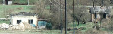
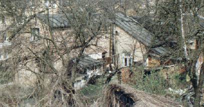
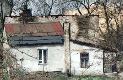
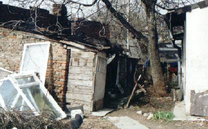
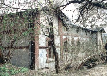
Below is a series of pictures, arranged as a walk through Wieniawa, from the hillside above the northeastern corner of the former lake, down and up along Leszczynskiego, and finally around the stadium on Przy Stawie.
Discussion & Chat Forums
Acknowledgements and Sources
The history of Wieniawa was pieced together from several books, the
most significant being:
Lublin Przewodnik, Wydawnictwo Test 2000. ISBN 83-7038-169-3.
This is a comprehensive guide to Lublin, in Polish.
Zydzi Lubelszczyzny 1914-1918, Konrad Zielinski, ISBN
83-87833-11-8. A History Thesis on the Jews in the Lublin region during
the first world war, in Polish. Konrad also supplied some other information
and was kind enough to review the site.
Unknown. A guide to Lublin, in Polish, probably dating from
the 1930's. The cover and first few pages were missing.
The Rest - All color photographs and line drawings are my own,
as are all the comments on present day Wieniawa.